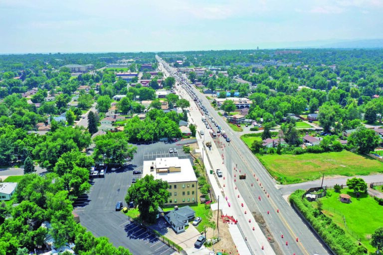
The next time heavy equipment and workers in yellow vests start moving dirt in a Wheat Ridge neighborhood, try looking online to find out what’s being built.
The city’s projects and properties map offers residents and businesses a place to find updates on city and private developments.
In an introductory video posted on the city’s YouTube channel, Senior Planner Ella Stueve hoped the maps are “What people think of first when they have questions like ‘what’s that construction going on down the street?’ or ‘what water district am I in?'”
In an email to the Gazette, Stueve said there is no single target audience for the maps.
“The purpose of the tool is to be useful to a wide range of different users, from residents to business owners to workers to developers to elected officials to city staff and I’m sure more,” Stueve wrote.
Paige Piper, executive director of Localworks, wrote in an email to the Gazette that she had used the map to get updates on projects happening throughout the city.
“I’m always curious to learn the status of new developments or find out what new businesses are coming into Wheat Ridge,” Piper added.
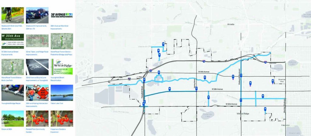
The map has three sections:
1) Private development: Mid- to large-sized private projects in four different stages:
• Under review — Such as zone change requests, subdivision and site plan review;
• Pending hearing — For example, zone changes and some site plans called specific development plans. When a project is scheduled for a hearing, those date(s) will be added to the map link;
• Approved/pending construction; and
• Under construction.
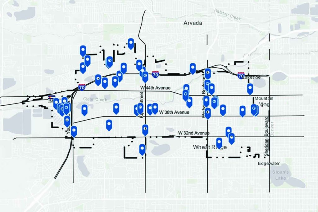
Users click on one of approximately 60 pins on the map or a thumbnail image to see the project description. For questions about private development not reflected on the map, call (303) 235-2846 or email [email protected].
2) City projects: Highlights 17 major city initiatives such as infrastructure, park improvements and land use planning efforts. Projects led by the Colorado Department of Transportation are not included. That information is on the Jefferson County Projects page of the department website.
3) Interactive property information: Basic information for residents, owners, brokers, developers and others, such as city limits, parcel lines, zoning, floodplain, city council and special district boundaries.
Anyone can explore the maps and email feedback or suggestions to [email protected].
Maps did not cost extra money
In an interview with the Gazette, Stueve said the city planning department needed a way to track its development-related work, and the city wanted an easy way for people to find the same information. The city’s 2021-22 strategic plan included a goal to “demystify” government, she added.
After more discussion and meetings, Stueve said the mapping approach was chosen.
The city’s 2022 budget included a new geographic information systems position to undertake the project, she added, “and put together so many different processes.”
“Around the same time, the city had its (2022 online) breach and (website) outage that brought out the need to address those types of situations,” Stueve said.
In September 2022, the city experienced an online $5 million ransomware attack against its computer systems. The city did not pay the hackers and eventually restored the systems using backups. But the incident brought out the need to prevent future attacks and was undertaken at the same time as the mapping project, Stueve said.Geographic Information System Architect Michael Hinkle said he started working on the project in March 2023, which debuted online in November.
“The software was already in use by the city as part of its GIS,” he noted, so the city did not have to make any further purchases. “It took a lot of coordination with many departments but it went well.”
Stueve stated the project had no cost estimate “because it was part of the city’s GIS license and the work we did after the breach had to happen.”
“The cost is essentially the time staff spends inputting data,” city spokesperson Amanda Harrison wrote in an email.
Stueve noted the Wheat Ridge project is unique among Front Range cities since it includes various development-related information in one place.
Hinkle said he used the experiences of a few other municipalities to help develop the Wheat Ridge maps.
Stueve added that someone who wants to explore the maps “doesn’t have to be an expert on how the city functions.”
She admitted there are some limitations, such as being unable to search for a project by its name and only some active building permits are included on the map. Addresses are used to identify each project’s location on the maps. A name search could be part of an update, Stueve added.
“We hope residents and businesses benefit from this, really anyone with an interest in knowing what’s going on,” Stueve said.